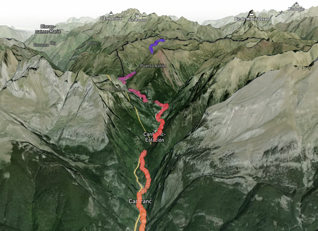
Do you want to see all the Caminos in 3D as you have never seen them before? Do you want to see how the Camino Francés through Aragón, along the valley of the Aragon River until it reaches Villanúa? Or the mountains of O Cebreiro? Or the cliffs of the Camino del Norte? Or the arrival at Fisterra? Here it is.

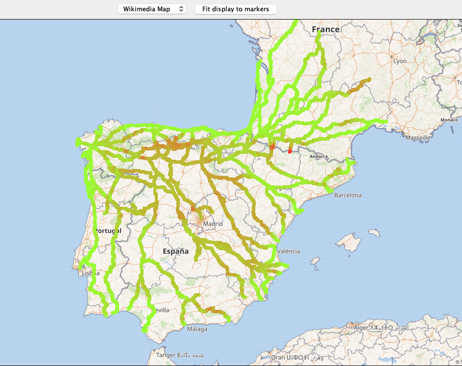
What you will be able to explore in the following map is based on all the GPX files available in the CNIG (National Centre for Geographical Information of Spain) portal. This information has been provided by the Asociación de Amigos del Camino de Santiago.
After downloading each of the 1,015 individual files corresponding to all the stages of all the variants of all the Caminos, I have unified them into a single database of GPS points. After processing, I used the Mapbox map service to display all the information and to have the 3D engine available. Please explore the map… and use the CTRL key to enjoy the Caminos in 3D view.
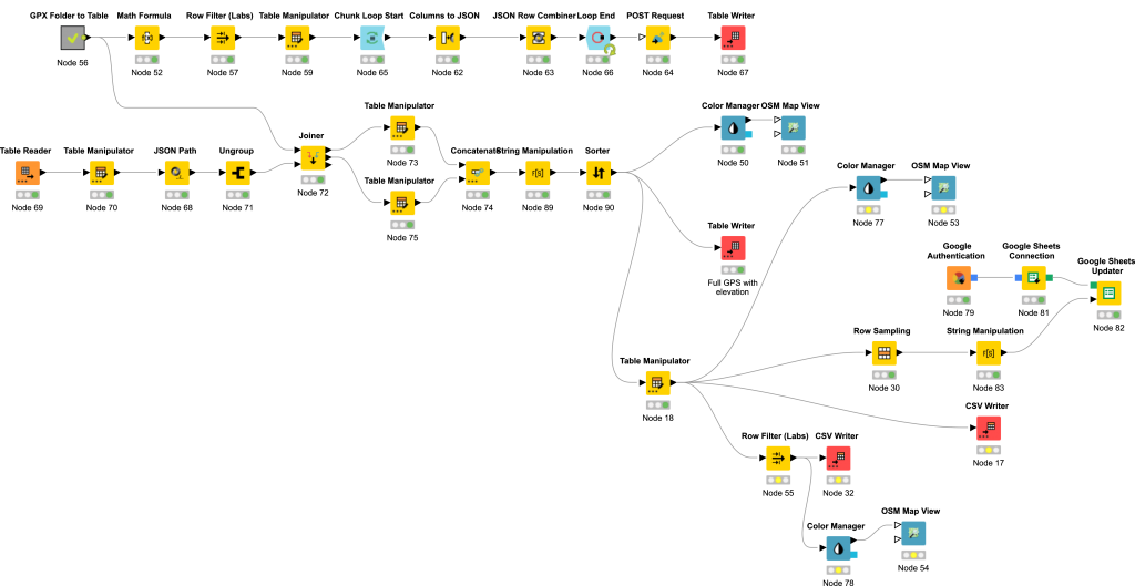
Using for this loading and transformation process (#ETL), the #nocode tool par excellence, KNIME Data Science & Analytics Platform, in addition to the massive processing of more than 398,000 GPS points, I have included the elevation data for each of the coordinate points.
Here you have the details of the process I followed and the tools used.

This is just a summary of the article that you can read:
- Database of GPX files with the stages of the National Center of Geographic Information (CNIG). We can never thank enough for the work they do in dissemination and compilation to the Spanish Federation of Associations of Friends of the Camino de Santiago (FEAACS). It has been absolutely core for build all the Caminos in 3D.
- KNIME Data Analytics Platform. Here is a preview of the workflow I used. As you can see, I have used it mainly for the process of ingesting, transforming and updating data before uploading them to the data visualization services. This time, the focus was on updating the elevation data in order to generate the profiles of the stages, variants and selected Caminos.
- Open Elevation API. in their own words: “Open-Elevation is a free and open-source alternative to the Google Elevation API and similar offerings.”. Really straightforward.
- MapBox. Possibly one of the best map services that already in its free version provides a lot of functionalities. Its mapbox Studio suite is a small wonder to generate maps. It also allows a 3D visualization with a breathtaking degree of detail.

What do you think? Would you like me to publish the complete and unified files of all the Caminos in 3D to make your own analysis? Leave me your comments to improve the result and make it as useful as possible.

Fabulous work! Well done!
Thank you Andrew!!
Do you miss something? Would you like to have anything else?
WOW amazing I just hope little ole me can navigate this … I love it and thank you for your hard work.
Thank you! 😊
Yes please.
This boggles the mind ! THANK YOU for this.
Thank you Denise! I’m already thinking in the next improvement 😊
I cannot believe how much work this must have been for you! Amazing!!! Thank you!!!!!!
Thank you Paul! 😊 I’m really glad you like it.
What feature does the Mapbox service provide for visualization? Regard Biomedis
Hi Biomedis, I just need to upload the route and point and Mapbox manage all the terrain and intersection.
I just walked the Camino Frances again (using your map). I felt like I was actually on the Camino (except no blisters and my knees aren’t sore). Excellent job sir!
Thank you very much Roberto!!
Wow, I just discover this. This is so cool.
I started doing it for myself but I think that for all of us we have walked the Camino is a small way to go back through them.